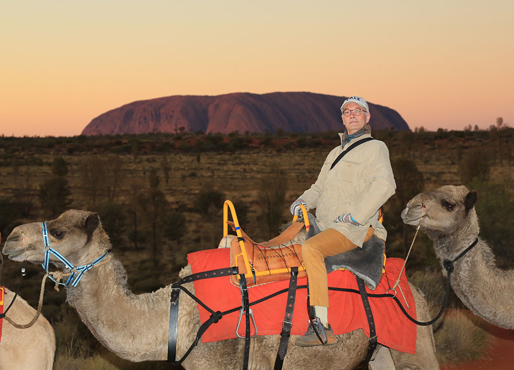
It feels very strange to get off a big Airbus A321 in the middle of nowhere: a vast, unending, empty flatness consisting of scrubby red dunes, but for two astonishing presences—Uluru (Ayers Rock), and Kata Tjuta (the Olgas) about 25 miles farther distant. I spent the whole afternoon gazing at both from the top of a dune, and marvelling at the constantly changing effects of light, accelerating and intensifying with the approach of dusk and sunset. The view is of the canonical north side of Uluru, which presents itself at its most monolithic: an astounding red…thing. In truth, however, “red” and “thing” are terms as adequate for Uluru as blue is for the Pacific. As you experience it, the deep plums and slate greys, the dusty pinks and peaches, the oranges and buttery yellows, the purplish-browns and earth-ochres, all wax and wane over the surface of Uluru with the movement of clouds and the sun. On the way back from Kings Canyon a few days later I remarked to the helicopter pilot that the rock was distinctly mauve when we left, but was upon our return more of a violet with navy blue shadows, and a few hints of tangelo here and there. My pilot absorbed this in taciturn silence, which is pretty much the standard conversational mode among western-desert locals.
In those few minutes before sunset, the whole rock glows yellow, then fiery orange, then blood red – the effect is produced by the refraction of light from the setting sun. From a distance it looks immense, though this is actually not quite true. The rock stands only about 1,200 feet above the plain, and is about four miles all the way around the base – so while very large indeed, it is not Annapurna. Everything flows from the singularity of its appearance, as against the huge expanse of surrounding flatness. There is also an inevitable sense of dialogue with Kata Tjuta, which is in fact much bigger in area, and, at the summit of Mount Olga, some 600 feet higher than Uluru. Otherwise there is for the stranger that initial sense of infinite surrounding flatness. I say initial, because the effect of being there for more than a few days is that by some curious sleight of hand the emphatic nowhere gradually gives way to somewhere, and, finally, here – and with that “here” you become aware of the otherwise scarcely perceptible serration on the southern horizon which is the Musgrave Ranges, the obvious rationale for the east-west border between South Australia and the Northern Territory which they originally defined, and now straddle. The same is true of Mount Connor, the immense mesa way off to the northeast, and such of the western end of the MacDonnell Ranges as are visible to the north from the tops of the highest dunes.
The geology of this place, so far as I can grasp it – for it involves unimaginable antiquity, and truly inconceivable forces – is as follows. Uluru consists of a coarse-grained sandstone rich in feldspar. The natural colour of that stone is light grey, but the redness on the surface was produced by the oxidization of particles of iron. The stone was formed by the gradual erosion of huge mountains that once consisted mostly of granite. Kata Tjuta is quite different, a conglomerate of pebbles and boulders of granite and basalt cemented by sand and mud, rather like an immense plum pudding. The wider region lies near the southern margin of the so-called Amadeus Basin, a depression in the earth’s crust that formed some 900 million years ago and, until approximately 300 million years ago was for long periods covered by a shallow sea which gradually collected sediments in the bed. These were dramatically compressed, crumpled and buckled about 550 million years ago in a massive event that threw up huge jagged mountains – think Himalayas, that sort of scale. Those mountains, the so-called Petermann Ranges, of which the insignificant remnant lies to the southwest, near the Western Australian border, eroded slowly and easily, much assisted by the action of the only forms of life that then existed: bacteria and algae. Uluru and Kata Tjuta are all that now remains of what was washed away from those mountains in a great fan extending thence to the northeast. The heavier bits plopped down sooner, obviously, in the vicinity of Kata Tjuta, while the finer sand travelled farther, forming the sediments of which Uluru consists. The sea receded about 300-400 million years ago, leaving behind further layers of mud and sediment at least a mile and a half thick. The rocks were then folded and fractured and thrown up above sea level in another massive geological event that is known as the Alice Springs Orogeny. In the course of that immense transformation, Uluru was turned nearly 90 degrees to its present position, and Kata Tjuta were tilted about fifteen to twenty degrees from the horizontal. The gradual processes of erosion that produced what we see and experience today commenced at that time, and continue. Both formations are merely tips of rock that extend as far as four miles down into the earth’s crust. Sonar technology tells us this, and, moreover, that Uluru is rather like an immense sandstone banana extending underground a long way to the northeast. What we now see is merely its stalk. The infinitely gentle topography of the surroundings, meanwhile—tens of thousands of square miles of it that vary in altitude by a matter of only dozens of feet to the crests of the dunes – are thought to have sat largely unchanged for at least 30,000 years, and samples of local bore water have been accurately dated to 5,000 BCE. You brush your teeth with water the retention of which occurred roughly when agriculture was invented. Archaeological evidence, meanwhile, suggests that the first people arrived in about 25,000 BCE, around the time when the Venus of Willendorf was carved and tinted with red ochre in what is now Austria.
That is the western view. According to the local people, the Anangu, who form part of the western desert Pitjantjatjara language group, the land was created out of nothing by part-human, part-animal, shape-shifting ancestor-beings in the Tjukurpa. The Tjukurpa was, is, a body of knowledge, transmitted orally, and taught to children with the aid of rock paintings. It tells of the creation, but it is much else besides. The Tjukurpa is a conceptual atlas and astronomical chart, a glossary, cookery book, medicine chest, code of ethics, body of law, hunting manual, and the basis of ceremonies – clan ceremonies, but also men’s business and women’s business, much of which is kept strictly separate, most of it actually. Religion being an entirely western (and modern) concept, the Tjukurpa is for the Anangu an entire cosmology – a body of knowledge, not belief. The point is that many of its precepts are duly inscribed on Uluru, and on Kata Tjuta, which make both at the very least sacred, though that too is an inadequate term. It is sacred by the singularity with which it forms the fulcrum of an entire order of life, natural, social and ethnic (to the extent that these three can even be prised apart, for they cannot). In other words, Uluru is the Congress, Supreme Court, White House, National Cathedral, National Archives, Library of Congress, elementary school, high school, university, Centers for Disease Control and Prevention, farmer’s market, hospital, post office, and city hall rolled into one, and for a single community that has only ever consisted of a few hundred people for whom the rock has functioned in this way for at least 20,000 years.
The ancestor-beings, many of whom are still present, are ancestors not only of the Anangu but also of the birds and animals that surround them, for instance the mala men – the mala being a small delicate wallaby that is only now being reintroduced to the region, having been pretty much obliterated by feral species. The slightest variation in topography, meanwhile, gives rise to a completely new and sharply contrasting botany, which is partly how they have come to conclude that the dune system has been so stable for so very long – long enough for plants to evolve into, and accommodate themselves to it. Beside the hoary spinifex, the mulga, the honey grevillea and other hardy shrubs and bushes, perhaps the most beguiling feature of the flat desert floor is the desert oak (Allocasuarina decaisneana) which for decades exists as a slender shrimp of a thing, patiently burrowing its tap root twelve yards down to the water table. If, with luck, it manages to get there, the tree then burgeons into a mature umbrella of shade, but it never gets very big at all. The largest desert oaks are upwards of 1,000 years old, the sine qua non of endurance. The skinny juveniles, with their approximately human dimensions, strike me as eerily humanoid, rather like the Bradshaw figures of the Kimberley region of far northern Western Australia – but this is an observation produced by too little knowledge drastically misapplied, yet I can’t help it. The desert bloodwood, meanwhile, produces a dark red sap that for millennia served the Anangu as a disinfectant for cuts, and a very effective eye wash. There is, in fact, a practical use for every nut, leaf, twig and berry throughout the entire region, but none is more plentiful, or indeed useful, than the mulga.
The mala men lived on the north side of Uluru, but conducted their inma, or ceremonies, on the very top. There they planted their ceremonial pole, the Ngaltawata, and had just commenced their rite when the mulga seed men arrived from the neighborhood of Docker River, about 70 miles to the west. The mulga seed men invited the mala men to come and be part of an inma in their country, but the mala men politely declined, for under the Tjukurpa it was not possible to interrupt their own inma once it was under way. The mulga seed men went home affronted and angry. The mulga seed elders decided to punish the mala men. They conjured a giant devil dingo, Kurpanya; sang it full of hate, and sent it out to drive away the mala men. Approaching in many devious disguises, Kurpanya first launched his attack on the mala women’s area at Uluru. From her cave high up on the rock, Lunpa, the wise kingfisher woman, saw through his disguise, and screamed a desperate warning that was not heeded until it was far too late. Kurpanya drove the terrified mala women and children into the middle of the mala men’s inma, causing chaos, and a terrible battle then ensued. The colossal Ngaltawata was knocked down where you see it today. Lunpa, the kingfisher woman, turned to stone, and remains in situ. You can still see the remains of the mala men who were killed in that battle, as well as the terrible scarring paw prints left by the vicious Kurpanya after he bounded up and over the rock. The rest of the mala men were driven away, and never came back.
Itjaritjari, the mole woman, lived in a cave at the bottom of the same valley where the mala men lived. She tunnelled about industriously, making the holes, cavities and shelters that are visible now. Itjaritjari loved watching the mala children playing in front of her cave, and she was on friendly terms with the mala women, for whom she dug a convenient, well-appointed cave for mala women’s business, thoughtfully adding a gigantic stone, a yuu, for a windbreak. It’s still there, and so is the spot inside that is rubbed glassy smooth, where, for millennia, Anangu women ground the mulga seeds into paste for cooking. That was before we turned up with bags of flour, sugar, backy, and alcohol – although apparently the Anangu smoked mulga twigs.
Lungkata, the blue-tongued lizard man, meanwhile, was greedy, fat and lazy. One day an emu, speared and mortally wounded a little earlier by the bellbird men, limped into his spot, and Lungkata seized the opportunity to bag an easy meal. While he was preparing to cook the tender emu meat, the bellbird men arrived and asked Lungkata if he had seen their wounded emu. “No emu here,” he said, furtively. “Maybe over that way.” Having temporarily deflected the bellbird men, Lungkata gathered up the emu meat and hurried with it up to his cave, which is high on the rock, carelessly dropping choice emu cuts on the way. The bellbird men eventually followed the emu’s tracks back to Lungkata’s fireplace, reached their own conclusions, and made straight for his cave. The bellbird men demanded from fat Lungkata the meat that was rightfully theirs, but the cowardly old culprit retreated farther into his cave, and said nothing. In a rage, the bellbird men lit a huge fire to flush out Lungkata, who, coughing and spluttering, slipped on the steep rock face and tumbled all the way down to the ground, turning into the big round stone that is still there. You can also see where he fell from his cave, together with frightful patches of burned skin that he left behind, together with charred remnants of the fire.
But surely the most haunting story, apart from that of the willy-wagtail woman, who pokes her nose into everybody’s business and talks about it to all and sundry, is that of Kuniya, the python woman. When her time came Kuniya came home to Uluru and laid her eggs in the cave called Kuniya Piti. You can see the immense wavy lines where she slithered out of the cave and roamed over the rock in search of food. While she was there, Kuniya's fugitive “nephew” Kuka Kuka – as with everything else, western notions of kindred and affinity don’t quite cut the mustard here, so the definition of nephew is necessarily broad – Kuka Kuka, as I say, sought refuge on the other side of the rock, having been chased there from Kata Tjuta by the poisoned snake men, the Liru. You can see the many marks in the rock that were made by the heads of the spears that were thrown by the Liru men, angrily pursuing Kuka Kuka. All but one of the Liru men gave up the chase and went home, but the one remaining poisoned-snake Liru man lurked in the valley of the Mutitjulu waterhole, gloating over the body of Kuka Kuka, mocking with laughter Kuniya the python woman. There a terrible battle took place between these two, the Liru man and Kuniya the python woman. In rage she threw a terrible rain of sand against the rock, the marks of which you can see very high up, and she eventually killed the Liru man with a blow to his head with her digging stick. You can still see the place where this colossal, mortal blow split the very rock from top to bottom. The grieving Kuniya carried Kuka Kuka’s body down to the waterhole, where both were transformed into rainbow serpents. They are still there, keeping watch over the waterhole. When it dries up, the rainbow serpents bring rain and fill it once more.
Sir James Frazer would have died and gone to heaven. Here we have everything: lessons about making sure to finish what you begin; rites of kinship; rules about property; rights and obligations relating to food; the importance of correctly identifying tracks, concepts of justice. We even have Cassandra in the form of Lunpa, the wise kingfisher woman – her cave is especially taboo. There is no way you can prevent people looking, but the Anangu would rather you didn’t. Photography is not allowed. Reading all this back is one thing, but to hear these stories in the lee of that most exceptional stone presence is simply electrifying. I did so on three occasions: an evening walk along the north face of the rock, past the children’s cave, where there are paintings; the men’s cave, and the very sensitive women’s cave. An early morning walk along the south side to the Mutitjulu waterhole, which is all gully and ravine, scar and rend – the contested place of Liru and Kuniya that is, at the same time, that most precious thing, a source of fresh water; and, on a third visit, to the new cultural centre, whose serpentine design is based on the same story. There, near the place where masses of tourists still insist upon climbing the rock, a sign makes it unequivocally clear: We, the Anangu, traditional and legal owners of this place, implore you please not to climb this rock, for to us it is sacred, and, moreover, when you get killed in a fall, or die from heat exhaustion or heart attack, this makes us sad and sorry. Your urine poisons our waterholes. So do the heavy metals in the spent batteries you discard from your cameras. The sign is in many different languages, yet scores of people evidently disregard it. Thirty years ago, when the land title “hand-back” occurred, the Commonwealth government brokered an agreement whereby traditional ownership would take the form of a long lease on the condition that for the time being tourists would be permitted to climb. It was felt that otherwise they would stay away, and the fragile local economy would wither on the vine. This, reluctantly, the Anangu accepted. Surely we have come so far, and made such excellent progress with Aboriginal reconciliation, that the time has come to close the rock to climbers, and tear out those offensive posts and the long chain that portly Germans, South Koreans and, yes, the rest of us whitefellas, use to haul our quivering midriffs up and up and right into the middle of the mala men’s inma. The fear is that if climbing were prohibited people would attempt it anyway, but I cannot believe that tourists would stop coming to this extraordinary place just because they weren’t allowed to climb up to the top. If reconciliation is to mean anything at all, surely we owe it to the Anangu not merely to respect the Tjukurpa, but to do our best to observe it while we are there.
On the Tuesday I got up in time to witness the dawn, and over the rock was draped a layer of vaporous cloud, very much like the one that habitually forms over Table Mountain in Cape Town, only the effect is, once more, heightened by astounding colour contrasts. Our guide then drove us to the south side of the rock so that we could walk its length (more or less). This is the side that presents a far more complex face, if that were possible, than the north, for it admits of numerous gullies and points of access to little water holes, caves (some with paintings, including sprigs of honey grevillea which grows all around), and promontory-like nodules, excrescences, bumps and cavities, some of them hundreds of yards more or less straight up. Dark stripes of lichen mark out the places where rain water descends, and some of these have eroded saucy corrugated channels, after the manner of a big dipper. The floor of the plain rolls up to the base of the rock like a spinifex and savannah carpet, and the sudden abruptness with which it looms out of the western desert makes it easy to understand why people ever presumed it was sacred.
The atmosphere is almost completely without humidity, so at this time of year the nights and early mornings are very cold. The extreme dryness becomes evident after walking in the open air for more than an hour or so, because your lips dry up. Water was so precious to the Anangu that they never used it for washing. Instead, fine red sand alone was their soapy water, their towel, and their box of kleenex.
Nothing captures the majestic scale of this landscape more than flying over it at 2,700 feet in a helicopter. From this height the slight bumps and serrations on the horizon assume the character of proper mountain ranges, and almost as soon as you take off you appreciate the neat geometry with which the Petermann Ranges, Kata Tjuta, Uluru, and Mt Connor arrange themselves along a more or less straight line. You also appreciate the vastness of Lake Amadeus, the long salt pan that formed an insuperable barrier to Ernest Giles when in 1872, from a spot over which we hovered at Kings Canyon, on the western end of the George Gill Ranges, he first saw and named Lake Amadeus and Mount Olga but despite his best efforts was unable to reach the latter on account of the former. From this same spot you immediately grasp why it was that, owing to the intrusion of an entirely imperceptible ridge, Giles could only see Mount Olga from there, for Uluru is neatly obscured by an obstruction that is, itself, invisible. Giles’s choices of name were, at first, intended to honour his scientific patron in Melbourne, Ferdinand von Mueller, who had lately been ennobled for services to botany and exploration by his sovereign the King of Württemberg. Instead Mueller afterwards insisted upon adopting the names of, respectively, the scientifically-minded King Amadeus of Spain (soon to be deposed by the Cortes), and Olga, the mineralogically-enthusiastic Russian-born queen-consort of Württemberg. Uluru (Ayers Rock), meanwhile, was eventually named for the surveyor-general of South Australia – rather more prosaic, but there we are. Nobody bothered to learn the Anangu-Pitjantjatjara names until comparatively recently.
The dune patterns north of Lake Amadeus are quite different from those that surround Ayers Rock. They are parallel, running roughly northeast-southwest, immensely long, and spaced more widely apart. Over this immense district are spread only a handful of huge cattle stations, including Tempe Downs and Kings Creek Station, each with a carrying capacity of barely a handful of beasts per square mile. We saw along the margin of a salt pan a herd of wild camels.
I had the previous morning visited Kata Tjuta, and walked the length of the Walpa Gorge, effectively hugging the tallest flank of the highest dome of the aggregation, Mt. Olga herself. It’s important to do this, because it brings home the utterly different character of the formation, and the friable, lumpy, spotty texture of the rock and its matrix. Reaching it by air at sunset, however, aboard my fire-engine red R44 Raven II helicopter, flying this time at 3,500 feet, gives you the fullest impression of this more mysterious and beguiling place – one wonders afterward why Uluru is the main attraction, for to me Kata Tjuta, the Olgas, are even more magical, if that were possible. If the rock is a sort of geological exclamation, a shout in the desert, the Olgas murmur or even hum instead. They then remain largely silent, but, despite this measure of softness and subtlety, they are in the end, I think, the grander presence—and incredible in the fullest sense of the word: such a powerfully counterintuitive and sombre presence rising in stone harmonies over many places, and not one. Anangu men evidently agree, for much if not most of the southern fringe of Kata Tjuta is out of bounds. Fair enough. I wouldn’t want strangers sauntering into my living room either. Still, I am glad I was able to see it (them) from the air, and afterwards witness the sunset over Uluru one last time. What you get from the elevated point of view is the awesomeness of the length of the shadow cast by the rock; in the moments before sunset this reaches as far as the horizon, a sight of unequalled splendour.
And now I have been back in Canberra for a month, processing and absorbing the whole thing. The Italians have an expression mal d’Africa, literally “Africa sickness.” Once you are bitten, so they say, the bug stays with you – and the pull is constant. I suspect I shall long feel the same way about the Pitjantjatjara lands of the Western Desert. I shall certainly go back.


